Showing posts with label road_design. Show all posts

Tuesday, July 18, 2017

Public Comment for the MD 28, Norbeck Road, and MD 198, Spencerville Road/Sandy Spring Road project AW068_11 (was MO886_11)

Please submit a public comment about MD-198 by July 19th!


Here's my message -- thanks Sebastian for producing a template that made it easier to put these items together.  


To: jbeck@sha.state.md.us
Cc: eric.luedtke@house.state.md.us, Tom.Hucker@montgomerycountymd.gov, craig.zucker@senate.state.md.us


Dear Mr Beck,

As a regular user of MD 198, I am pleased to see progress at making this road safer for bicyclists, pedestrians, and drivers. That being said, there is room for improvement.

I have been a long time resident of Burtonsville and have been a strong supporter of rebuilding this community into a destination via my participation in the design of the Burtonsville Crossroads Neighborhood Plan and continuing work through the Maryland Bicycle and Pedestrian Advisory Committee (MBPAC) and Montgomery County Bicyclists Advisory Group (MCBAG).   I envision and walkable and bicycle friendly business district with bicycle connections between all surrounding communities and parks.   To make this happen, I urge the State Highway Administration to make the following revisions to the MD 28/198 Corridor Improvement Study.

For all All of MD198/MD28
  • I support bike-friendly facilities, in particular, the off- road shared-use path on one side of MD 198 in areas with few driveways or curb cuts.  Areas that currently have a high density of access points should be reconfigured to reduce curb cuts/access.   The path and roadway should be separated by a green space buffer wide enough for tree planting to provide shade. 
  • The shared-use path should be wide enough for two directions of bicycles and pedestrian traffic and designed to be as straight as possible and for a reasonable bicycle cruising speed of up to 15-20 miles per hour. 
  • Crosswalks should be announced with markings and signage to warn drivers about crossing bicyclists and additional markings should be made where driveways cross the trail, possibly with raised crosswalks to slow drivers and raise awareness to trail users. 
  • High-speed, right- turn slip lanes that turn across the trail should be reconfigured to slow down turning vehicles and improve visibility of cyclists and pedestrians.
Critical recommendations for SHA Project Management Division, Segment D (Burtonsville):
  • Comply with the Burtonsville Crossroads Neighborhood Plan by providing a landscaped median with breaks to establish a grid of local streets, enhance safety, and improve access to businesses.  This would look more like the Alt-3 Access Management Profile.  
  • Lanes should be narrowed from 11 ft to 10 feet to discourage speeding and bring a more residential/commercial quality to the business district.
  • In addition to lane with reductions, speed limit through Burtonsville Business District should be set to a maximum of 25 mph.
  • Overhead utilities should be cleaned up and buried.
  • Widen grass buffers between sidewalks and road to 6 ft to allow streetscaping.
  • Widen bike lanes to 5 ft and add 2 ft buffer from travel lanes to improve safety.
  • Add traffic circles at Old US-29 and MD-198 and at Old Columbia Pike (diagonal intersection) and MD-198.  This will facilitate those who need to make U-Turns since left turns will be essentially eliminated through the Business District with the exception of a traffic light at the Burtonsville Town Square intersection.
Critical recommendations for SHA Project Management Division, Segment E (West Laurel):
  • Add second turn lane from McKnew Road to MD 198 or add a signalized intersection at Cedar Tree to relieve the aggressive behavior people exhibit when attempting to leave the community.  
  • Drivers leaving McKnew Rd to MD-198 should not have any turns while MD-198 through traffic is green.  The limited visibility and speed of traffic in this segment makes even right-on-red dangerous.   Additionally, a bicyclist on the shoulder has no bailout area due to the volume and speed of traffic which is a problem when vehicles routinely make continuous right-hand-turns on red (without a stop). Even with a stop, the vehicles are pulling well into the bicyclists useable shoulder area. 
  • The MD-198/McKnew intersection should be completely controlled, including left turns with red-arrows from MD-198 to McKnew to prevent the frequent collisions that occur today.   
Critical recommendations for the SHA District 3 office include:
  • Allocate funding for intersection improvements at MD 198 and Peach Orchard Rd.
  • Install traffic signal at Burtonsville Town Square.
  • Install speed activated signs in 25 and 30 mph speed zones.
  • Provide crosswalks for people to safely cross MD 198 (see Coalition to Fix 198 document for locations).
Critical recommendations for Montgomery County include:
  • Install gateway landscaping and signage at entrance to Burtonsville retail district.
  • Accelerate funding for Burtonsville Access Road.
  • Draft amendment to state legislation to clarify applicability of speed cameras.
  • Construct sidewalk on McKnew Road to connect to MD 198.
  • Extend Sidewalk on North side of MD-198 from 4140 Sandy Spring Rd to McKnew Rd to allow pedestrians a place to walk while not forcing crossings midway.  Also allows safer access to bus stop.

Thank you for the opportunity to comment on the study. I encourage you to review the full report developed by the Coalition to Fix MD 198 (download at: https://goo.gl/LUCzepfor more recommendations.


Sincerely,

Stephen Ashurst


Thursday, April 6, 2017

Maryland Legislation 2017

I've recently sent an a record amount of letters to my legislators about both worthwhile and horrendous bills.  Here are some of my top subjects:


I supported these bills:
  • HB0578 - Vehicle Laws - Pedestrian Hybrid Beacons (cross-filed: SB0338)
    • Amendments have jointly been made by Bike Maryland, State Highway Administration and other sponsors to conform to the Federal Highway Administration standards. 
    • Almost all motorists (99%) of drivers adhere to these Beacons and 76% of cyclists and pedestrians understand and use them. Pedestrian Hybrid Beacons save lives.
  • HB0332 - Montgomery County - Maximum Speed Limits Outside Urban Districts MC 23-17
    • This would give Montgomery County the authority to set speed limits as low as 20mph on certain roads outside urban districts.  This will give local engineers another option in their tool bag so they can make certain streets safer.
  • HB0997 - Vehicle Laws - Bicycles, Play Vehicles, and Unicycles - Operation on Sidewalks and in Crosswalks
    • This would allow bicycles to operate lawfully on sidewalks and in crosswalks.     This bill adds legal protections for bicycles that are at the same level as pedestrians when using sidewalks and crosswalks.
  • HB0011 - Vehicle Laws - Causing Diesel Emissions to Discharge Onto Another - Prohibition
    • Intentional emissions of diesel exhaust is a menace to cyclists, runners, and drivers. I've personally had a truck do this while driving in Montgomery County.  This dangerous practice should be prohibited.
    • Video of this action happening to a cyclist: https://youtu.be/h8k8bhGrXIo


I do not support these bills:
  • HB1451 - Left Lane Use for Passing
    • This bill only seems to enable and legalize speeding on our roadways. Maryland roadways are severely congested already and even in normal flowing traffic conditions, all lanes must be used, whether passing or not. In order to move all traffic down the road, all lanes must be used. 
    • There are many specifics missing from this bill. We don't know how long is "too long" to say in the left lane. As vehicle speeds vary, even while passing, it may be impossible to always continue passing as someone in the right lane speeds up. Also for left exits, there's no rule about how far in advance of the exit we may enter the left lane. For an area, such as MD-32 and I-95, I generally get in the left lane to go from MD-32 E to I-95 N almost 2 miles in advance knowing that if I wait till I'm only one mile or one-half mile from the exit, it may be backed up and I won't be able to merge into the left lane. On roads like US-29 with stop lights and left turns all along it, there's no reason for people to move out of of the left lane, and doing so would only cause chaos as people are concerned with getting tickets for being caught in the left lane for too long. 
    • This is a dangerous bill to people's safety while traveling our roads. It will encourage speeding and aggressive driving and likely enable more road rage incidents.
  • HB1456 - Vehicle Laws – Passing to the Right – Use of Shoulder
    • This bill makes no mention about the safety of pedestrians and bicyclists using the shoulder in a legal manner.   Even completely focused drivers, not to mention distracted drivers, are rarely verifying the shoulder is clear of these vulnerable users before bolting around a vehicle just to save a second or two of time.   This bill endanger these users of the road and shoulder.   Instead of passing this bill, a future bill to require re-engineering of roadways to allow for proper, safe left-turns while keeping a through lane open and preserving the shoulder and perhaps a protected bike lane would be more appropriate.


I encourage you to contact your legislators and get involved with your community and state level issues.

Saturday, January 30, 2016

Unplowed Lanes Reveal Overbuilt Roads

One of my favorite unplowed sections along one of the many @MDSHA roads.
John's Hopkins Road between US-29 and Montpelier Rd

With the map above, I filled in sections of road that went unplowed for about a week after the 2016 Snowzilla storm.   I'm only highlighting the westbound direction, but there were also lanes missing from the eastbound direction.  

As you can see by the graphic, the two exit lanes from US-29 South to Johns Hopkins Rd westbound disappeared as soon as the ramp ended.   Also the dedicated left turn lane that is protected by a cement curb was also unplowed.   With the latter, this meant that the signalized left turn would never activate since vehicles could not be present and therefore could not be detected.   For vehicles turning right onto Montpelier Rd, they needed to merge to the middle through lane and then make a right around the pedestrian island when they would normally have a large radius non-stop turn.  

So here we have a road designed with essentially 5 lanes westbound with one dedicated right and one dedicated left turn and 3 through.   With this snow pack on the road, it was reduced to two combination lanes (a yielding left turn/thru and a right/thru lane).

Did the reduction in lanes affect the LOS (a measurement used by the SHA as standard practice to determine how many lanes to build)?   We must remember that schools were canceled all week and OPM allowed liberal leave or late start times, but most people were back at work by Thur/Fri, with OPM starting work on-time Friday.   The rush hour traffic moved smoothly through this area and nobody had to wait extra light cycles to navigate through this intersection.  

Is this road overbuilt?   Probably.    Can the extra lanes be changed into protected and separated bike lanes?  Yes, with the enormous amount of space available by just one 12-14 FT wide lane, wide bike lanes with wide buffer protection would be absolutely possible.  The buffer could be large planters that would offer a great deal of protection, although many other options exist.  

Do you know of other roads that handled traffic at an acceptable LOS while a lane or two was covered with snow?  


Monday, November 24, 2014

Montgomery County Bill for Safer Streets (Bill 33-13)

The final reading for Bill 33-13 is scheduled for tomorrow morning.

http://www.montgomerycountymd.gov/council/resources/files/bill/2013/packets/20131210_4c.pdf

This bill:

  1. defines target speeds for roads,
  2. lane widths,
  3. safety improvements,
  4. and ultimately commands multi-modal road use.
This bill could be improved, nevertheless:
With the option for alternative standards by the Executive with only a notification, the bill remains weakened.  I would have even more support if the Executive would need approval from the Council before an exception was approved. Additionally, this bill provides for some technical implementation for curb radius build-out, but lacks technical enforcement of the speed.   I would recommend speed humps be included along any commercial suburban/urban zones where the target speeds are 30mph or less.   The demand for slower speeds, in this bill, warrants my full support, even if technical specifications are missing.
I urge you to show your support for this bill.   You can do so easily at: http://salsa3.salsalabs.com/o/2041/p/dia/action3/common/public/?action_KEY=15180

Thank you Councilmember Berliner and Councilmember Riemer for sponsoring this bill.


Update:


http://www6.montgomerycountymd.gov/Apps/Council/PressRelease/PR_detailsnew.asp?PrID=14287


Montgomery County Council Enacts Bill to Redefine Road and Sidewalk Standards Bill Adopts Safe Speed Limits, Makes Communities Safer for Pedestrians and Bicyclists, Particularly in Emerging Urban Areas
 
  • Release ID: 14-351
  • Release Date: 11/25/2014
  • Contact: Neil Greenberger 240-777-7939 or Delphine Harriston240-777-7931
  • From: Council Office 
The Montgomery County Council today unanimously enacted Expedited Bill 33-13 that will limit the width of travel lanes, turning lanes and parking lanes, as well as the size of intersection curb radii in urban areas. The bill also will set target speeds at which vehicles should operate in urban business districts to provide mobility for motor vehicles and for a safe environment for pedestrians and bicyclists. Some of the new guidelines are particularly aimed at the emerging urban areas that are developing around various areas of the County.

The bill, which was sponsored by Councilmembers Roger Berliner and Hans Riemer, requires certain road improvements to include a sufficient pedestrian refuge area, directs developers building road improvements to add curb ramps where appropriate and requires curb ramps to be built in accordance with federal American with Disabilities Act (ADA) best practices.

Councilmembers Berliner and Riemer convened a working group of staff from the Council, the County Planning Department, the County Department of Transportation (DOT), the Montgomery Fire and Rescue Service and the Department of Permitting Services. The group met five times in October and November, and was assisted by Toole Design, a planning firm under contract to DOT that has considerable experience in the development of complete streets standards and guidelines.

Among the key aspects of the legislation was to set “maximum target speeds” to provide mobility for motor vehicles and a safe environment for pedestrians and bicyclists. This provision focuses on urban areas, but would not set target speeds in suburban and rural areas. The target speed for all County streets in urban areas would be 25 mph, unless otherwise specified in an adopted master plan or Capital Improvements Program.
"I am proud that the Council has passed a ‘complete streets’ measure that will make our urban nodes safer for all users,” said Councilmember Berliner, who chairs the Council’s Transportation, Infrastructure, Energy and Environment (T and E) Committee. “By narrowing lanes and turns, providing for more pedestrian refuges, and designing roads for lower speeds, we can make sure that our urban areas are places that will attract residents old and young. Our urban rights of way must be made accessible to all users, not just drivers. I look forward to working with the Department of Transportation on regulations that will further this movement toward a complete streets philosophy, a progressive approach to our urban streets."

To help achieve safe speeds, the bill generally limits road lanes to no wider than 10 feet, although the Planning Board or County Executive are given the authority to grant a waiver for improvements by a develop if a 10 foot-wide or 11 foot-wide lane "would significantly impair public safety.” A single traffic lane is generally designed to be 12 feet wide under most current standards.

Although a few County streets have lanes that are narrower, especially for left turns, 10 feet is considered the minimum width that can accommodate general traffic on a through lane. There is less room to maneuver in 10 foot-wide lanes than in the more standard 11-and 12-foot-wide lanes.
"Our residents want and deserve the high quality of life that well designed urban areas can provide, and this legislation will help the County move forward to provide them,” said Councilmember Riemer, who also is a member of the T and E Committee. “We want to create districts where people can walk and bike and feel safe, while cars can still move but the streets are comfortable for all users."

Sections of the law apply to all County roads, including the provision to create separated and buffered bike lanes. Separated bike lanes (also known as cycle tracks) have not been defined in the County Code, although they have been included in at least two recently adopted master plans. The new law defines a bike lane as a bikeway that is separated from motor vehicle travel lanes by a physical barrier, such as a landscape panel or a line of parked cars. It also defines a buffered bike lane as one that is separated from motor vehicle lanes by striped pavement.

The law encourages the building of sidewalks when road projects are developed. The previous law leaves broad discretion to the Council and the Planning Board on whether sidewalks must be installed with a road project. The new law limits that discretion to four situations: in very low density rural zones, along rustic or country roads, where limits on impervious surfaces apply and on tertiary residential streets where the Planning Board finds that a sidewalk is unnecessary. 


                                                                # # # #

Monday, September 8, 2014

Add Bicycling Infrastructure -- We Know it Works!

Here we have another data point articulating what we already know, separated bike lanes improve the movement of people via all modes of transportation.   In the article When Adding Bike Lanes Actually Reduces Traffic Delays from CityLab, NYCDOT describes how they took a five car-lane road and reconfigured it with four smaller motor vehicle travel lanes, adding a parking, and a buffer and finally a six foot bike lane and actually improving travel times.  


Friday, May 30, 2014

Montgomery County Transit Forum

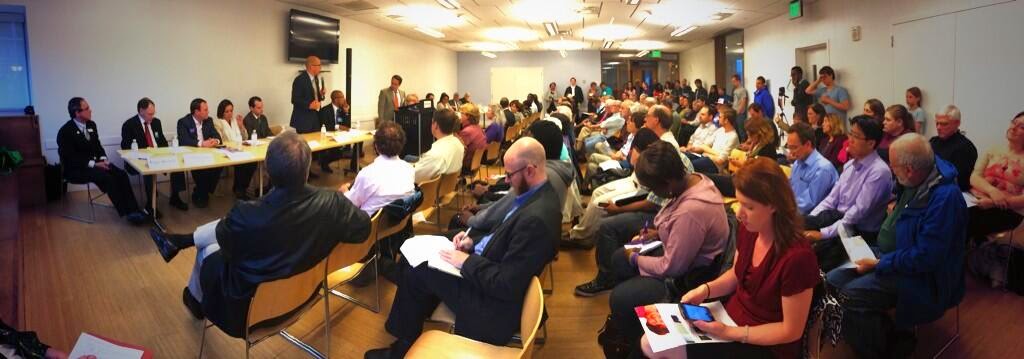
Montgomery County Transportation Forum Photo
Photo by Greg Billing

Although I was not able to attend the #mocotranspo (Montgomery County Transportation Forum) I was able to get a sense that our communities and representatives understand that the primary mode of transportation via car is outdated.  Let's hope all of our candidates will continue to push for better transportation options as indicated by these live tweets from the forum.

Thanks all for your support, let's make it happen!

Saturday, May 24, 2014

Pinch point, Old Columbia Pike, Burtonsville

Southbound on old Columbia pike leaving Buttonsville, I've had many a close call/near miss at this pinch point where the shoulder, wide enough before and after, shrinks in size on a curve which many cars judge incorrectly and drive into the shoulder area, leaving little room for me to move right to avoid being hit.  

Please review the short video of this spot.  Hopefully this choke point can be removed. 


Monday, July 9, 2012

Road Design Resources

Excellent post highlighting sources for road design and more specifically road accommodations for bicycles.    See the post by Mr. Cochrane at cyclemoco.com.


Wednesday, June 20, 2012

Streetsblog with Ray LaHood

Thank you for posting this Q/A to fastlane.dot.gov courtesy of dc.streetsblog.org.  These important initiatives can only help the current situation where roads have been primarily designed with a car centric mindset.   I believe that the federal government can help, but ultimately the choice lies with the  state and local municipalities.  


Friday, May 4, 2012

Burtonsville Crossroads Neighborhood Plan - Public Hearing Scheduled for June 7th

The Burtonsville Crossroads Neighborhood Plan staff draft was presented to the Planning Board, which in turn voted to hold the public hearing on June 7th.  The details will be posted on June 1st with the Planing Board agenda.

I've briefly mentioned my take on the draft plan and I welcome the upgrades that are planned for Burtonsville.  Although there are some recommendations about traffic handling, I'm hoping that the Planning Board is working with the SHA to ensure a shared vision of the MD-198 corridor.  As a bicyclist, I'm unsure that the amount of traffic and traffic speeds will be tolerable through this busy stretch of road.   The target speed for MD-198 from Old Columbia Pike to the US-29 overpass should be set at 25 MPH, knowing that most drivers will exceed this limit by 5-10 MPH.   The current plan calls for setting the speed limits at 30-35 which puts real vehicle speeds at 35-45 MPH through a congested area.  This alone will deter most recreational and novice bicyclists.   Even if I'm not riding the roads, I wouldn't be inclined to walk or visit the area with ever-present vehicle noise.    

To build a community where people spend time shopping and visiting with friends while making use of alternative transportation modes (walking and bicycling), we need to ensure a relatively quiet town center with safe, quiet roads leading in and out of town, including the main thoroughfares.   


Wednesday, April 18, 2012

Multilane Roundabouts Dangerous for Bicycles

I recently had the opportunity to travel through 5 or so roundabouts on a recent bicycle ride.   Four of those occurred over a small stretch of MD-216 located near US-29 in Howard County.  Although I'm a fairly confident road cyclist, I found these roundabouts difficult to navigate safely.   Due to the multilane nature, it became nearly impossible to control vehicles from passing me in the left lane, and then cutting me off as they went essentially straight through, while I was in the right lane making a 270 degree turn.  Additionally, vehicles entering the roundabout as I was passing their entrance never stopped (nor yielded the right-of-way) and almost took out a fellow cyclist behind me.    There must be a better way to design multilane roundabouts so that vehicles and bicycles can be accommodated safely.    

The Maryland SHA has stated on it's own website that these multi-lane roundabouts are inherently more dangerous than standard single lane roundabouts unless proper facilities have been provided.  
http://www.sha.maryland.gov/Index.aspx?PageId=288

"For multilane roundabouts, bicycle safety at roundabouts has been found to be poorer than at other intersections unless separate bicycle or multi–use paths are provided around the outside of the roundabout."


View Roundabouts on MD-216 in a larger map
This map above shows the location of the four multilane roundabouts discussed.


Worse yet, after exiting Circle 3, I encountered one of the most dangerous exits/merge areas for a bicyclist. 


Google Map - Heading East on MD-216 after exiting Circle 3  


Cars and bikes are forced to share a single curbed lane that narrows.   Cars are traveling at or above the speed limit by this point.  From the right, traffic has exited US-29 and is merging onto MD-216 and these vehicles are traveling at speed when the two lanes meet, leaving bikes stranded between two lanes of fast traffic separated by a dashed white line.   If there is a line of cars exiting from US-29, bikes cannot quickly merge to the right shoulder and must remain in the middle of the left lane.   Again, remember, vehicles in the left lane are traveling at speed and don't understand why bicycles would be out in their lane.

Perhaps a better option would be to create a bike large bike lane that cuts through the medium early giving bicycles a safe place to stop and eventually enter this section of road via the right merge lane.


The Maryland SHA needs to re-examine these particular roundabouts, and it would be prudent to identify a better standard for multilane roundabouts where bicycles can safely navigate.  I believe that roundabouts do make cycling safer, and following the design principles in the following document should allow all users to remain safe.
http://www.apbp.org/resource/resmgr/webinars/roundabout_design_final_slid.pdf
 

Wednesday, November 9, 2011

Make it Human Friendly

While driving some local roads, I thought about this blog's topic.   The current title, "Make It Bikeable" encompasses what I believe to be the most critical infrastructure improvement that can be made in our area.   But honestly, it's narrowly focused.

Today's streets are unsafe for bicyclists, pedestrians, and drivers alike.    What we need are streets designed to be safe for all users.   This means that streets are engineered so that all users can progress without conflict.

Merging lanes with unclear signs, streets with no accommodations for bicycles, sidewalks barely wide enough for a baby stroller all lead to conflicts with other humans.    Humans make mistakes and poor decisions and where there is an unclear or poorly designed facility, conflict will occur. 

Here is a blog entry I came across as I was researching the possibility of a new title for this site: http://www.rebexart.com/english/blog/?p=72

I believe all states and municipalities have the resources and responibility to create human friendly infrastructure. 


Wednesday, September 21, 2011